

Local Weather and Outdoor Reports
INFORMATION UPDATES EVERY TEN MINUTES
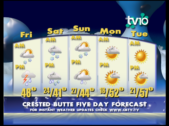
CB 5 Day Forecast
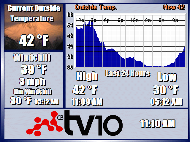
CB TEMPERATURE: 24HR
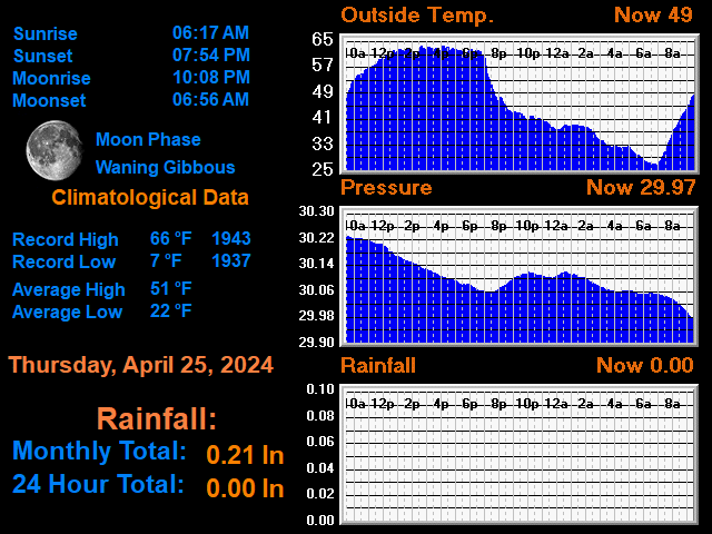
CLIMATOLOGICAL DATA
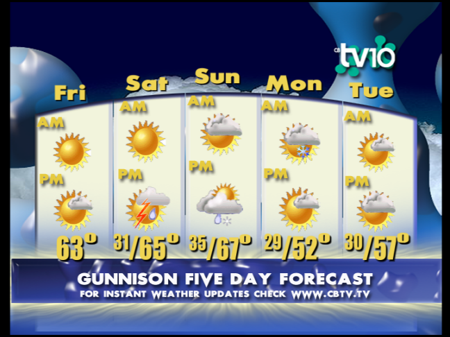
Gunni 5 Day Forecast
CB WIND: 12HR

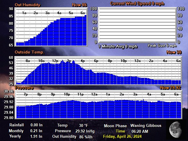
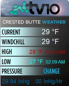
GENERAL DATA
FORECAST
4/7: Clouds and maybe some rain.
TV10 Crested Butte and Gunnison Valley Daily Weather Update- For 4/7: Weak moisture feeding in from the west has fed heavier and more consistent cloud cover keeping lows warmer than we’ve seen but not producing any moisture to the ground so far. This will be the trend through the day with highs warming well above normal even with the clouds and some scattered showers through this evening when skies will clear again.
Temperatures: Lows were warmer at 27 for Gunni and 25 for CB. Highs will reach 62 for Gunni and 54 for CB. Lows tonight will cool a little as skies clear.
Outlook: We are looking at a dirty zonal western flow that will offer sunny skies mixing with periods of cloud cover that could produce some isolated showers this week. These will hold off until Thursday and be spotty at best but by Friday night we see increasing moisture as a pacific low moves in for a wetter weekend. Expect changes as the pattern develops but this may offer wetter conditions into the new week.
*Please note that the web cams below are not operated by CBTV and the consistency with which they refresh is beyond our control.
WEB CAMS
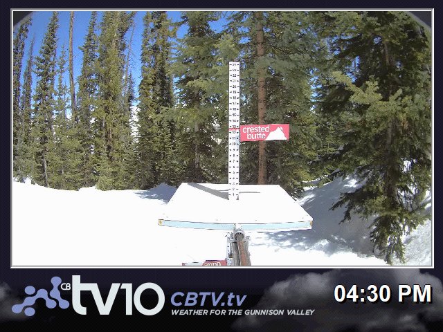
POWCAM
POWCAM 3:55
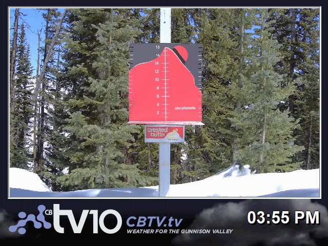
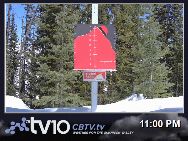
SNOW STAKE
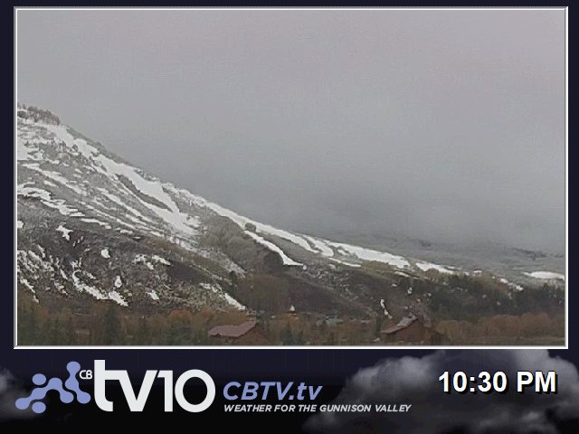
WHETSTONE MTN.
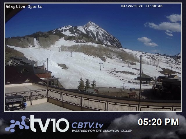
ADAPTIVE SPORTS CENTER
WHETSTONE 2
BLACK CANYON NP
ELK CREEK BLUE MESA
BC GRIZZLY RIDGE

CB RTE 135 NORTH

ALMONT RT135
GUNNISON US50 WEST

US50 26rd BLUE MESA

MONARCH PASS

DAILY TIMELAPSE VIDEOS
WHETSTONE TODAY: TIMELAPSE
WHETSTONE YESTERDAY: TIMELAPSE
POWCAM TODAY: TIMELAPSE
POWCAM YESTERDAY: TIMELAPSE
BLACK CANYON TODAY: TIMELAPSE
BLACK CANYON YESTERDAY: TIMELAPSE
ADAPTIVE BASE AREA TODAY: TIMELAPSE
ADATIVE BASE AREA YESTERDAY: TIMELAPSE
QUICK CONDITIONS
Featured Partner