

Local Weather and Outdoor Reports
INFORMATION UPDATES EVERY TEN MINUTES
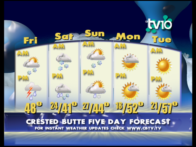
CB 5 Day Forecast
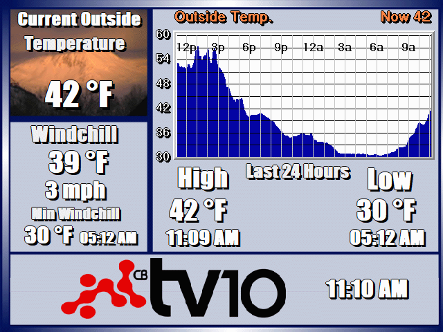
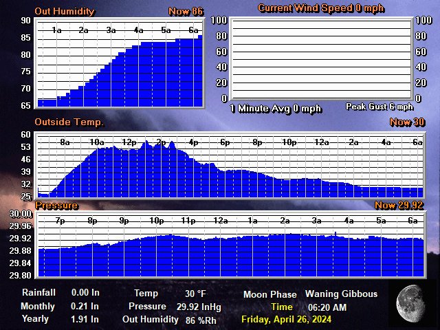
CB TEMPERATURE: 24HR
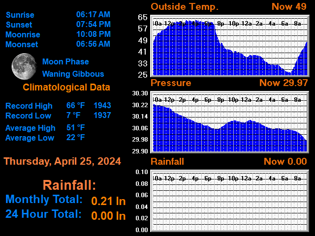
CLIMATOLOGICAL DATA
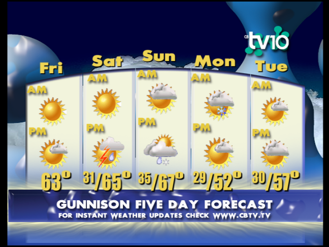
Gunni 5 Day Forecast
CB WIND: 12HR

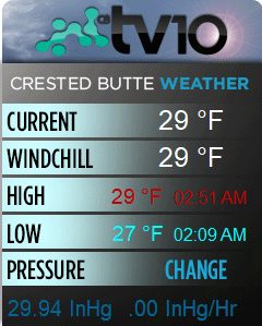
GENERAL DATA
FORECAST
7/20: More afternoon build up.
TV10 Crested Butte and Gunnison Valley Daily Weather Update- For 7/20: High pressure remains stuck and the east to west flow will hold for another day offering a sunny start with afternoon build up. The convective nature of the afternoon storms keeps them hit or miss with the higher terrain favored earlier before spreading into the lower valleys. Take advantage of calmer conditions early and be prepared this afternoon.
Temperatures: Lows were mild at 51 for Gunni and 45 for CB. Highs have swerved back into the heat with Gunni likely reaching 90 and 83 for CB. Lows tonight will be similar.
Outlook: Tuesday will offer another day of the same but then we start to see the center of this high drop to the southeast which will pivot the flow and allow for more moisture through Thursday. The more southern tilt will mean an increase in available moisture with more consistent rains but also the classic convective components with gusting winds, small hail and lightning all possible. The high wobbles back into the area to close the week but hopefully it’s a good shot of moisture in between. Keep the layers handy and get early starts.
*Please note that the web cams below are not operated by CBTV and the consistency with which they refresh is beyond our control.
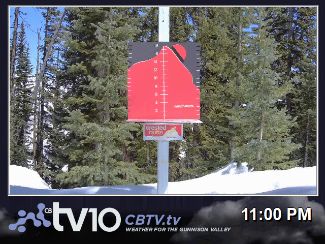
WEB CAMS
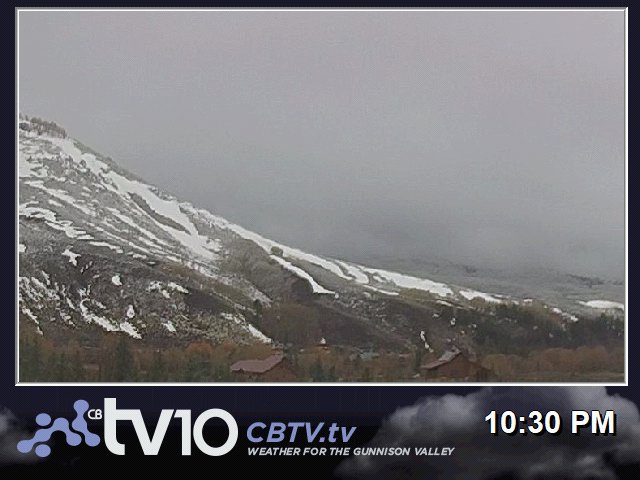
WHETSTONE MTN.
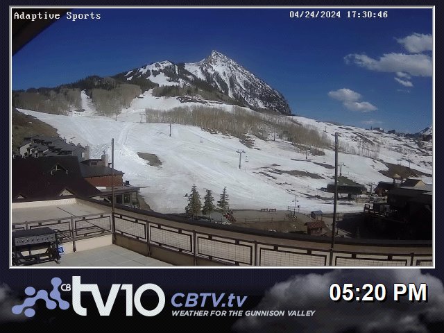
ADAPTIVE SPORTS CENTER
WHETSTONE 2
BLACK CANYON NP
ELK CREEK BLUE MESA

BC GRIZZLY RIDGE

CB RTE 135 NORTH

ALMONT RT135
GUNNISON US50 WEST

POWCAM
US50 26rd BLUE MESA

MONARCH PASS

DAILY TIMELAPSE VIDEOS
WHETSTONE TODAY: TIMELAPSE
WHETSTONE YESTERDAY: TIMELAPSE
POWCAM TODAY: TIMELAPSE
POWCAM YESTERDAY: TIMELAPSE
BLACK CANYON TODAY: TIMELAPSE
BLACK CANYON YESTERDAY: TIMELAPSE
ADAPTIVE BASE AREA TODAY: TIMELAPSE
ADATIVE BASE AREA YESTERDAY: TIMELAPSE
QUICK CONDITIONS
Featured Partner